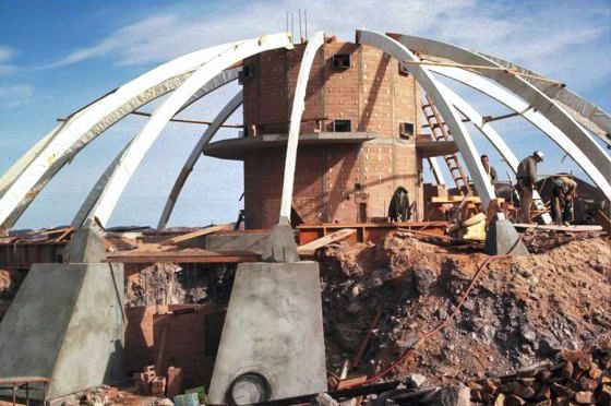
One of the monuments in the Cajon Pass that visitors will view during a program to rededicate the Stoddard-Waite Monument. (City of San Bernardino)
CONTRIBUTED CONTENT
Riverside Press-Enterprise
The San Bernardino Historical and Pioneer Society will sponsor an event celebrating the 100th anniversary Re-dedication of the Stoddard-Waite Monument in the Cajon Pass on Saturday, May 18.
The monument was dedicated May 18, 1913, to honor early pioneers who came through the pass on horseback and wagon. Sheldon Stoddard and Sidney P. Waite, who traveled through the Pass in 1849, were among those who attended.
The monument sits along the Santa Fe/Salt Lake Trail, near the truck scales along southbound Interstate 15 south of Highway 138, on property owned by the San Bernardino County Museum.
Saturday’s activities will begin at 9 a.m. at the society’s Heritage House at Eighth and D streets in San Bernardino, when President Steve Shaw will welcome the group and present a slide show on the history of the Pioneer Society.
At 9:30 a.m. there will be a presentation to descendants of Stoddard and Waite.
At 10 a.m. the group will begin a convoy to a 1917 monument on Wagon Wheel Road in the Cajon Pass, from which they will walk 300 yards to the site of the 1913 monument.
At 11 a.m., San Bernardino County Museum caretaker Mike Hartless will talk about the Indian village and burial ground, followed by San Bernardino historian Nick Cataldo, who will talk about the history of the site, including the Inman Ranch. Stoddard and Waite family members also will speak.
At 12:30 a.m., after a no-host lunch break, the group will hear from historian Richard Thompson about the 1917 monument and the Brown Toll Road. Historian John Hockaday will talk at 1 p.m. about Camp Cajon.
Afterward, the group will walk up the toll road to see the bridge piers for Crowder Canyon, and drive to the Upper Toll House site.
Email Yankeenut@excite.com or call 909-709-3792 for more information.
Thursday, May 16, 2013
Tuesday, April 30, 2013
Oh the Places You'll Go: 38,000 Historical Maps to Explore at New Online Library
The Digital Public Library of America announces the addition of a vast treasure trove of maps.
A map from Joseph and James Churchman's 1833 volume "Rudiments of National Knowledge, Presented To The Youth Of The United States, And To Enquiring Foreigners" (David Rumsey/DPLA)
Rebecca J. Rosen
The Atlantic
More than three decades ago, David Rumsey began building a map collection. By the mid-90s he had thousands and thousands of maps to call his own -- and his alone. He wanted to share them with the public.
He could have donated them to the Library of Congress, but Rumsey had even bigger ideas: the Internet. "With (some) institutions, the access you can get is not nearly as much as the Internet might provide," Rumsey told Wired more than a decade ago. "I realized I could reach a much larger audience with the Internet."
Bit by bit, Rumsey digitized his collection -- up to 38,000 maps and other items -- along the way developing software that made it easier for people to explore the maps and 3D objects such as globes online. Today, the Digital Public Library of America announced that Rumsey's collection would now be available through the DPLA portal, placing the maps into the deeper and broader context of the DPLA's other holdings.
"I am very excited to have my digital library of historical maps added to the DPLA," Rumsey was quoted as saying in a DPLA press release. "Maps tell stories that complement texts, images, and other resources found in the growing DPLA library."
To see exactly what this means in context, click on any one of the 38,142 results that come from a search for "David Rumsey." Once you've clicked through to, say, this 1838 globe, you'll notice a little module on the right (I've put a screenshot of it here as well) that invites you to "view on timeline." Click there and you'll arrive at a page with all of the DPLA's other materials from that year.
In addition, Rumsey's maps will now be available through the DPLA's API, meaning people who are creating location-based apps will be able to tap into the historical resources of the collection.
The DPLA, as with much of its "holdings," doesn't actually hold anything at all -- rather, they use Rumsey's metadata to make it all searchable and accessible through DP.LA, but when it comes time to look at an object up close, you'll be linked over the David Rumsey's own site. It's not about what the DPLA has so much as how it presents and connects what is already out there.
As DPLA executive director Dan Cohen told me earlier this month, "By bringing them together, I think we're also in a sense making those collections much more usable. When people come to the website, first of all, they'll be able to find a lot of content that exists out in smaller archives and collections much more easily. They won't have to go to hundreds or thousands of websites to find this amazing, unique scanned content from America's heritage and, indeed, from the world's."
A map from Joseph and James Churchman's 1833 volume "Rudiments of National Knowledge, Presented To The Youth Of The United States, And To Enquiring Foreigners" (David Rumsey/DPLA)
Rebecca J. Rosen
The Atlantic
More than three decades ago, David Rumsey began building a map collection. By the mid-90s he had thousands and thousands of maps to call his own -- and his alone. He wanted to share them with the public.
He could have donated them to the Library of Congress, but Rumsey had even bigger ideas: the Internet. "With (some) institutions, the access you can get is not nearly as much as the Internet might provide," Rumsey told Wired more than a decade ago. "I realized I could reach a much larger audience with the Internet."
Bit by bit, Rumsey digitized his collection -- up to 38,000 maps and other items -- along the way developing software that made it easier for people to explore the maps and 3D objects such as globes online. Today, the Digital Public Library of America announced that Rumsey's collection would now be available through the DPLA portal, placing the maps into the deeper and broader context of the DPLA's other holdings.
"I am very excited to have my digital library of historical maps added to the DPLA," Rumsey was quoted as saying in a DPLA press release. "Maps tell stories that complement texts, images, and other resources found in the growing DPLA library."
To see exactly what this means in context, click on any one of the 38,142 results that come from a search for "David Rumsey." Once you've clicked through to, say, this 1838 globe, you'll notice a little module on the right (I've put a screenshot of it here as well) that invites you to "view on timeline." Click there and you'll arrive at a page with all of the DPLA's other materials from that year.
In addition, Rumsey's maps will now be available through the DPLA's API, meaning people who are creating location-based apps will be able to tap into the historical resources of the collection.
The DPLA, as with much of its "holdings," doesn't actually hold anything at all -- rather, they use Rumsey's metadata to make it all searchable and accessible through DP.LA, but when it comes time to look at an object up close, you'll be linked over the David Rumsey's own site. It's not about what the DPLA has so much as how it presents and connects what is already out there.
As DPLA executive director Dan Cohen told me earlier this month, "By bringing them together, I think we're also in a sense making those collections much more usable. When people come to the website, first of all, they'll be able to find a lot of content that exists out in smaller archives and collections much more easily. They won't have to go to hundreds or thousands of websites to find this amazing, unique scanned content from America's heritage and, indeed, from the world's."
Tuesday, April 23, 2013
MITCHELL CAVERNS: Seeing state budget cuts up close
Mitchell Caverns are in the the Providence Mountains of eastern San Bernardino County (Mark Muckenfuss/staff photo)
BY JANET ZIMMERMAN
Press-Enterprise
California’s budget crisis hit me full-force recently when I realized Mitchell Caverns in the Mojave Desert’s Providence Mountains State Recreation Area are closed indefinitely.
These unique caverns, developed as a private tourist attraction in the 1930s, are not someplace I go often — I’ve only been there once. But on our spring break vacation in the desert, my husband and I wanted to take our children to see the caverns’ stalagmites, stalactites and other limestone formations.
We called, but the phone went unanswered. A little research turned up the reason.
The Providence Mountains State Recreation Area was closed in January 2011, along with 69 other state parks; 208 parks remain open. The area, which is within the boundaries of the Mojave National Preserve, became a state park in 1956.
According to the National Park Service, which includes notice of the closure in its newsletter for the Mojave preserve, said there were serious problems with the water system at the caverns, which coincided with state budget cuts.
The closures were necessary to meet $11 million in funding cuts that year, and $22 million this year, state officials said.
Sad to think, the only way my children may ever see this desert treasure is on video.
BY JANET ZIMMERMAN
Press-Enterprise
California’s budget crisis hit me full-force recently when I realized Mitchell Caverns in the Mojave Desert’s Providence Mountains State Recreation Area are closed indefinitely.
These unique caverns, developed as a private tourist attraction in the 1930s, are not someplace I go often — I’ve only been there once. But on our spring break vacation in the desert, my husband and I wanted to take our children to see the caverns’ stalagmites, stalactites and other limestone formations.
We called, but the phone went unanswered. A little research turned up the reason.
The Providence Mountains State Recreation Area was closed in January 2011, along with 69 other state parks; 208 parks remain open. The area, which is within the boundaries of the Mojave National Preserve, became a state park in 1956.
According to the National Park Service, which includes notice of the closure in its newsletter for the Mojave preserve, said there were serious problems with the water system at the caverns, which coincided with state budget cuts.
The closures were necessary to meet $11 million in funding cuts that year, and $22 million this year, state officials said.
Sad to think, the only way my children may ever see this desert treasure is on video.
Thursday, April 11, 2013
Monument on Route 40 nearing 85th anniversary
![]() |
| The Madonna of the Trail monument on Route 40 near Beallsville turns 85 this year. |
Trib Live
Notices on the front page of the Saturday, Dec. 8, 1928, edition of The Charleroi Mail touted such bargains as Brunswick talking machines at the Schroeder Piano Company and fresh country eggs at 45 cents a dozen at Alfieri Poultry.
But the major headline was this: “Dedicate Pioneer Madonna Statue Today At Nemacolin.”
The story under that banner recounted the first of two major events heralding the dedication of the Madonna of the Trails monument on Route 40 between Beallsville and Richeyville. The area statue, which will mark its 85th anniversary later this year, is one of 12 monuments dedicated to the spirit of pioneer women in the United States.
Mrs. John Trigg Moss of St. Louis, chairwoman of the National Society of the Daughters of the American Revolution's National Old Trails Committee, was the featured speaker at a banquet Friday, Dec. 7, at The George Washington hotel in Washington, Pa. Hosted by the Washington County Chapter of DAR, the event served as a prelude to the unveiling of the Pennsylvania monument scheduled for 2 p.m. Saturday at Nemacolin Country Club.
The banquet, according to The Charleroi Mail, was “one of the most successful and enthusiastic affairs of the kind ever held in Washington.” In addition to representatives of the Washington County Chapter members from the Monongahela Valley and Canonsburg chapters also participated in the festivities.
Mrs. N. Howland Brown of Norristown, state regent of Pennsylvania DAR; Mrs. Lowell Fletcher Hobart, a former state regent of Ohio and at present a national officer; Mrs. William H. Alexander of Monongahela, state vice regent-elect of Pennsylvania, and Margaret Barnett of Markleton, were among the honored guests at the speakers' table.
Among the longtime members of the Washington chapter in attendance were Dr. Louise J. Lyle of Mount Pleasant Township and Margaret Bureau of Washington.
The Washington County chapter was organized in 1892 and was recognized as being the third oldest in the state. Bureau became a member in July 1893, and Nancy J. Hall, regent of the chapter, presented her with a rose for each of the 35 years she had been a member.
Music for the banquet was furnished by Virginia Aley, pianist; Alma Headley, violinist; Harry Miles, violinist, and Paul E. Harding, violinist, all members of the Washington High School orchestra.
Hall called upon the honored guests and others who had taken a prominent part in securing the Madonna monument for the county for remarks. In introducing James. P. Eagleson of Washington, she referred to him as the “one person, very sincere and very earnest in the work, without whose efforts there would have been no Madonna of the Trails statue in Washington County.” She said Eagleson “has been the one person who worked untiringly from the very beginning and afterwards when defeat seemed certain ... he never stopped and was never discouraged and finally overcame every obstacle thrown in the way of securing the Pennsylvania monument for the county.”
The Madonna of the Trail monuments were commissioned by the National Society of DAR and located in each of the 12 states along the National Old Trails Road (Route 40), which extended from Cumberland, Md., to Upland, Calif.
The monuments were created by sculptor August Leimbach and are designed as a symbol of the “courage and faith of the women whose strength and love aided so greatly in conquering the wilderness and establishing permanent homes.” As noted on the Internet encyclopedia, Wikipedia, the statues feature a pioneer woman cradling a baby with her left arm and holding a rifle with her right hand. Her young son clings to her skirts.
In addition to the Route 40 monument, which is located directly across the highway from the main entrance to Nemacolin Country Club, other statues in order of their dedication are in Springfield, Ohio, Wheeling, W.Va., Council Grove, Kan., Lamar, Colo., Albuquerque, N.M., Springerville, Ariz., Vandalia, Ill., Richmond, Ind., Upland, Calif., and Bethesda, Md. The area monument was the 10th to be dedicated in the series of ceremonies in 1928 and 1929.
Harry S Truman, who would become U.S. president in 1945, was president of the National Old Trails Association at the time of the dedication of the initial Madonna monument on July 4, 1928, in Springfield, Ohio. Speaking at that event, he praised the pioneer women this way:
“They (the women) were just as brave or braver than their men because, in many cases, they went with sad hearts and trembling bodies. They went, however, and endured every hardship that befalls a pioneer.”
In addressing the audience in Washington, Eagleson emphasized that “it was team work” that brought the Pennsylvania monument to Washington County. He recalled the Fifty-Fifty Club, which made possible the greater of the money necessary, and he referred to it as “the most unique club ever formed.” Membership, he said, was limited to 50, each of whom donated $50. The 50 members were in all parts of the county and were subscribed in less than 10 days. When the membership pay was closed, Eagleson said, it was found that there were exactly 25 men and 25 women in the group.
“Its work has been completed and the list of members will be placed in the member box in the back of the statue to be opened in 50 years,” he said, adding that each member was invited to be present at that time.
A large crowd attended the dedication ceremonies on Saturday, Dec. 8, 1928, filling the clubhouse at Nemacolin Country Club to capacity. The event was held indoors because of the threat of inclement weather. The only part of the program that took place outside was the actual unveiling of the monument, which required only a few minutes.
National, state and county leaders of the Daughters of the American Revolution attended the ceremonies including Mrs. William H. Alexander of Monongahela, state vice regent-elect and former regent of the Monongahela Valley chapter. Others were:
Mrs. Alfred J. Brosseau, president-general of the National Society DAR; Mrs. E. Howland Brown, Pennsylvania regent; Mrs. John Trigg Moss, chairman of the Old Trails Committee; Mrs. Lowell Fletcher Hobart, candidate for president-general in the 1929 election; Margaret Barnett, also a candidate for national office; Mrs. Robert Reed, former state regent of West Virginia; Mrs. J.W. Endsley, regent of the Great Crossings chapter; Dorothy McNary, Canonsburg regent; Ethel Boughner of Uniontown, former state officer; and Washington County chapter regent Nancy J. Hall.
Eagleson, who again was lauded for his efforts in bringing the monument to Washington County, presided during the ceremony.
Appreciation also was extended to Charles E. McGinnis, president of Nemacolin Country Club, for his enthusiastic work in securing the donation of land from the club for the monument after the site had been selected by the National DAR organization.
Eagleson explained that the site for the monument had to be on the National Road (Route 40) and he finally selected the knoll near the entrance to the country club. He said McGinnis was “very receptive” to the idea and “in a short time the approval of the board of directors was secured and a deed for the site was given by the club.”
The Charleroi Mail called the site “beautiful ... far better than any that could have been secured in Washington.”
“Standing on the summit of a hill, facing the historic old National Road, over which the pioneer mothers traveled a hundred years and more ago in covered wagons with their husbands, seeking new homes in the wilderness of the ever receding far west, it may be seen by the tourists of today for several miles in both directions,” the newspaper said. “On the grounds opposite the Nemacolin Country Coub has been erected a large flood light, which will be turned on the statue every night, so that it will be seen by persons traveling after dark.”
Thousands upon thousands of travelers have viewed the Madonna of the Trail monument near Beallsville since that dedication nearly 85 years ago.
The massive statue, which stands 10 feet high and with its base towers about 18 feet above the highway, has been refurbished and rededicated several times over the years. Members of the Washington County and Monongahela Valley chapters of DAR have been, and continue to be, committed to its preservation and the spirit and courage it symbolizes.
That tradition is continuing today with another restoration project that includes landscaping and installation of railings on the steps leading to the statue.
Mary Holets of Monongahela, a director of the Monongahela Chapter DAR, said plantings of new trees and shrubbery will “enhance the appearance” of the area around the monument.
“The landscapers began their work before Christmas and it is hoped that everything will be completed by June,” said Holets, a 50-year member of DAR. “Like everything else, the workers were at the mercy of the weather during the winter.”
Holets emphasized that all Pennsylvania chapters of the DAR support the restoration projects with financial contributions for the upkeep of the monument.
“The statue certainly has endured the weather and other conditions since it was originally dedicated in 1928,” Holets said. “It is very symbolic, of course, and especially meaningful because it is one of only 12 such monuments in the United States. The state DAR and all of its member chapters are dedicated to perpetuating its significant place in history.”
Deborah L. Davis of the National Pike Chapter in Washington is the state DAR regent and will lead a rededication of the monument that is likely to take place when the current restoration is completed.
Sunday, April 7, 2013
Rare visit to the Mitchell Caverns
Naturalists from the SCV push back the desert to earn a rare visit to the now closed, historic, caveDeep in El Pakiva Cavern are numerous formations over which the imagination can take flight. One docent saw in this formation “A woman with a flowing gown with crossed arms and a Poodle’s head.”
By Jim Harris
Santa Clarita Valley Signal
It nearly takes my breath away.
Billowy, white cotton candy clouds march eastward, covering the top of Fountain Peak; its red sentinel spires pushing through feathery cloud-fog.
Descending the mountain are wide, uneven strips of crimson, gray and green; rhyolite and limestone.
“See the three layers?” asked Brian Miller, organizer of our trip to the currently closed Mitchell Caverns in the Providence Mountains State Recreation Area.
“The gray band—that’s where the caves are,” he says.
The caverns are opened to us in exchange for work to push back the Mojave Desert at the Mitchell Caverns Visitor’s Center.
Brian Miller, an employee of the state parks system, enticed his fellow docent/naturalists from Santa Clarita with the chance to be the first in three years to descend into the limestone caverns in exchange for pushing back the encroaching desert.
More than 20 volunteers from Placerita and Vasquez Rocks Nature Centers drove up to the remote site, 116 miles east of Barstow on Highway 40 for the chance to go into the deep, historic caverns.
The volunteers spent hours rooting out desert vegetation that was pushing into buildings, as well as intruding on concrete walkways and planters at the Mitchell Caverns Visitor Center.
“I’m tired,” said Laneita Algeyer, school trips coordinator at Placerita Nature Center. She and her husband Bill are veteran hikers who haunt places like Mitchell Caverns, looking for the historic and the unusual all through the West.
Jim and Toni Crowley brought a wheel barrow and extra tools in their pickup. They haul out the vegetation when the work ends.
Exhausted after hours of work, and a hearty lunch including soup provided by Sue Wallendar, the Placerita/Vasquez group was fired up once more when Miller announced, “Time for the Caverns.”
Suddenly, a Grounds Keeper appeared to lead us into the cave. So remote are the caverns in Fountain Peak that he had to turn on a generator to provide lighting for us as we descend into the caverns. The Caverns are off the grid.
We followed a craggy, rocky trail under Fountain Peak’s red spires, dug into the Mountain’s gray limestone band. On the left the trail plunged hundreds of feet below.
But, we were safe with a solid chain guard rail installed during the heyday of park building after the state park system took possession of the Caverns.
The safety rails were among many improvements Jack Mitchell, the original owner of the caverns, could not have imagined when he ran tours there on his own property.
Mitchell started the tours during the Great Depression of the 1930s.
Mitchell played at mining, but what he really excavated was the imaginations and spirits of people who wanted to see and experience unique and mysterious works of nature.
And in that spirit, as we descend into the caverns, many among us gasped as the lights turned on. The upward lighting cast strange shadows on bizarre, outlandish limestone formations.
“Breathtaking,” said Dolores Olson, fellow docent/naturalist.
Stalagmites, stalactites, shields, helictites, draperies, curtains and popcorn form intricate, sensational formations that illuminated our imaginations. Like children looking at clouds, we could see in our mind’s eyes that which are not there.
“Do you see the Queen washing her face in the basin, her hair hanging down?” asked the caretaker as he pointed to a complex formation of curtains, and stalactites in a section of the Caverns known as “The Queen’s Chambers.”
“Those formations will continue building. This is a living cave, when it rains,” continued the Grounds Keeper.
He pointed to a single trickle of water hanging on the end of a stalagmite, and then down at a tiny stalactite exactly below the motionless drip. This is at the beginning of our descent into the Caverns beginning at El Pakiva, “The Devil’s House” Cavern.
“This is how the formations grow over the years,” said the Grounds Keeper.
To me it was fantastic to think that such a small thing will grow like the enormous formations surrounding us as we continued.
Through El Pakiva we continue down state constructed steps, a far cry from the days when Mitchell and his visitors had to wriggle and climb over and around rocks and boulders.
After El Pakiva, we move in single file through the “Solution Tube” and are stopped abruptly at “The Pit.”
Here, in the 1930s, Mitchell dropped flares which would slowly go out, never to be seen again, said the Grounds Keeper.
“Jack (Mitchell) called it the ‘Bottomless Pit’,” smiled our guide. “It’s not bottomless; it’s about 40 feet deep.”
In those days the tour had to stop, go back, wriggle again through the entrance and walk the trail to the second cavern, Tecopa, named after one of the last Shoshone chiefs.
Now, there is a bridge and an opening to Tecopa, both built by the state.
There was also air-lock doors between the two caverns to eliminate a steady draft that blew through the caves once the state connected them together.
Archaeologists have found the remains of prehistoric animals, including a pre-historic sloth in Tecopa Cavern.
Throughout these caves there is evidence of Native-American life. The caverns were a sacred place for the Chemehuevi Indians, and a number of tools and fire pits have been found.
The Chemehuevi people called the caves the “the eyes of the mountain” because of their double entrances located near the top of Fountain Peak Mountain.
Much later, Jack Mitchell owned the caves (from 1934 to 1954) and operated them as a tourist attraction and rest stop for travelers on nearby U.S. Route 66. He held mining rights to the area and mined several holes and tunnels, which can be seen today.
In 1956 the caves became a state recreation area.
“They are an island of state owned land within the federal Mojave National Preserve,” said Miller.
The Caverns were closed in 2011.
Like the closing of Mitchell Caverns, we ended our tour as we emerge from Tecopa Cavern into the sunlight of Fountain Peak Mountain, and thread back along Jack Mitchell’s old cavern trail, sadly leaving behind our fantastical experience.
And back to our normal lives in the Santa Clarita Valley.
By Jim Harris
Santa Clarita Valley Signal
It nearly takes my breath away.
Billowy, white cotton candy clouds march eastward, covering the top of Fountain Peak; its red sentinel spires pushing through feathery cloud-fog.
Descending the mountain are wide, uneven strips of crimson, gray and green; rhyolite and limestone.
“See the three layers?” asked Brian Miller, organizer of our trip to the currently closed Mitchell Caverns in the Providence Mountains State Recreation Area.
“The gray band—that’s where the caves are,” he says.
The caverns are opened to us in exchange for work to push back the Mojave Desert at the Mitchell Caverns Visitor’s Center.
Brian Miller, an employee of the state parks system, enticed his fellow docent/naturalists from Santa Clarita with the chance to be the first in three years to descend into the limestone caverns in exchange for pushing back the encroaching desert.
More than 20 volunteers from Placerita and Vasquez Rocks Nature Centers drove up to the remote site, 116 miles east of Barstow on Highway 40 for the chance to go into the deep, historic caverns.
The volunteers spent hours rooting out desert vegetation that was pushing into buildings, as well as intruding on concrete walkways and planters at the Mitchell Caverns Visitor Center.
“I’m tired,” said Laneita Algeyer, school trips coordinator at Placerita Nature Center. She and her husband Bill are veteran hikers who haunt places like Mitchell Caverns, looking for the historic and the unusual all through the West.
Jim and Toni Crowley brought a wheel barrow and extra tools in their pickup. They haul out the vegetation when the work ends.
Exhausted after hours of work, and a hearty lunch including soup provided by Sue Wallendar, the Placerita/Vasquez group was fired up once more when Miller announced, “Time for the Caverns.”
Suddenly, a Grounds Keeper appeared to lead us into the cave. So remote are the caverns in Fountain Peak that he had to turn on a generator to provide lighting for us as we descend into the caverns. The Caverns are off the grid.
We followed a craggy, rocky trail under Fountain Peak’s red spires, dug into the Mountain’s gray limestone band. On the left the trail plunged hundreds of feet below.
But, we were safe with a solid chain guard rail installed during the heyday of park building after the state park system took possession of the Caverns.
The safety rails were among many improvements Jack Mitchell, the original owner of the caverns, could not have imagined when he ran tours there on his own property.
Mitchell started the tours during the Great Depression of the 1930s.
Mitchell played at mining, but what he really excavated was the imaginations and spirits of people who wanted to see and experience unique and mysterious works of nature.
And in that spirit, as we descend into the caverns, many among us gasped as the lights turned on. The upward lighting cast strange shadows on bizarre, outlandish limestone formations.
“Breathtaking,” said Dolores Olson, fellow docent/naturalist.
Stalagmites, stalactites, shields, helictites, draperies, curtains and popcorn form intricate, sensational formations that illuminated our imaginations. Like children looking at clouds, we could see in our mind’s eyes that which are not there.
“Do you see the Queen washing her face in the basin, her hair hanging down?” asked the caretaker as he pointed to a complex formation of curtains, and stalactites in a section of the Caverns known as “The Queen’s Chambers.”
“Those formations will continue building. This is a living cave, when it rains,” continued the Grounds Keeper.
He pointed to a single trickle of water hanging on the end of a stalagmite, and then down at a tiny stalactite exactly below the motionless drip. This is at the beginning of our descent into the Caverns beginning at El Pakiva, “The Devil’s House” Cavern.
“This is how the formations grow over the years,” said the Grounds Keeper.
To me it was fantastic to think that such a small thing will grow like the enormous formations surrounding us as we continued.
Through El Pakiva we continue down state constructed steps, a far cry from the days when Mitchell and his visitors had to wriggle and climb over and around rocks and boulders.
After El Pakiva, we move in single file through the “Solution Tube” and are stopped abruptly at “The Pit.”
Here, in the 1930s, Mitchell dropped flares which would slowly go out, never to be seen again, said the Grounds Keeper.
“Jack (Mitchell) called it the ‘Bottomless Pit’,” smiled our guide. “It’s not bottomless; it’s about 40 feet deep.”
In those days the tour had to stop, go back, wriggle again through the entrance and walk the trail to the second cavern, Tecopa, named after one of the last Shoshone chiefs.
Now, there is a bridge and an opening to Tecopa, both built by the state.
There was also air-lock doors between the two caverns to eliminate a steady draft that blew through the caves once the state connected them together.
Archaeologists have found the remains of prehistoric animals, including a pre-historic sloth in Tecopa Cavern.
Throughout these caves there is evidence of Native-American life. The caverns were a sacred place for the Chemehuevi Indians, and a number of tools and fire pits have been found.
The Chemehuevi people called the caves the “the eyes of the mountain” because of their double entrances located near the top of Fountain Peak Mountain.
Much later, Jack Mitchell owned the caves (from 1934 to 1954) and operated them as a tourist attraction and rest stop for travelers on nearby U.S. Route 66. He held mining rights to the area and mined several holes and tunnels, which can be seen today.
In 1956 the caves became a state recreation area.
“They are an island of state owned land within the federal Mojave National Preserve,” said Miller.
The Caverns were closed in 2011.
Like the closing of Mitchell Caverns, we ended our tour as we emerge from Tecopa Cavern into the sunlight of Fountain Peak Mountain, and thread back along Jack Mitchell’s old cavern trail, sadly leaving behind our fantastical experience.
And back to our normal lives in the Santa Clarita Valley.
Friday, April 5, 2013
Volcano House
![]() |
| Volcano House (Katie Kland) |
Orange County Register
Chapman University has repurposed numerous historic buildings, but a spaceship-style home perched 150 feet atop a volcanic cone?
"We've never quite encountered a house like this," said Kris Olsen, vice president of campus planning and operations for Chapman University.
"The architectural design feels like Austin Powers meets George Jetson," Olsen said.
See more Volcano House images
The home, known as the Volcano House, was a gift to Chapman from the late Huell Howser, who hosted and produced the "California's Gold" travel series on PBS.
Chapman's plans for the Volcano House include poetry gatherings for faculty and students, artist retreats, and astronomy and biology studies.
The house is set on 60 acres in the Mojave Desert, where silence and starry nights reign. It has a 360-degree glass perimeter – 24 glass doors that can be opened to the desert breeze when the weather is suitable.
Inside, a circular stairway leads to a stargazing deck on the roof.
Making the property even more spectacular is a spring-fed lake at the foot of the volcanic mountain.
Olsen has been directing the restoration of the property, which started in earnest last spring and recently concluded.
The home's bones were good, but the property had some deferred maintenance and needed some minor interior fixes.
"We drained the lake and put a new clay bottom in it," Olsen said.
Chapman refurbished the electrical, sewer, heating, ventilation and cooling systems.
Aday Architects in Glendora was tapped to spruce up the interior, while keeping the midcentury architecture intact.
Even the shag rug in the sunken living room was replaced with a new one.
"We found a carpet mill that produces shag and replaced it with similar shag," Olsen said.
"It's in good function for accommodating people now," Olsen said.
In the future, Chapman plans to add dormitories at the base of the volcanic mountain to accommodate large groups for overnight stays.
Howser's gifts to Chapman stemmed from a friendship that was struck between Howser and Chapman's President Jim Doti.
It began with a note Doti wrote to Howser.
After Doti watched a "California's Gold" segment on Old Towne Orange, he invited Howser to the campus. "When I saw it, I was disappointed that he didn't come visit the Chapman campus," Doti said.
Howser took Doti up on the invitation and visited the campus a few months later.
It was love at first sight. "He just fell in love with Chapman, the spirit of the place and the people," Doti said.
Doti was one of a handful of people who knew that Howser was terminally ill.
Howser kept his illness private.
What many people didn't know – not even Doti – was that Howser was the owner of the Volcano House. That mystery was revealed when Howser put the home on the market a few years back for $750,000.
People who knew Howser knew him as a longtime resident of the El Royale Apartments in Los Angeles.
Howser also owned a couple of other homes, but rarely used the Volcano House. He bought the Volcano House on a whim, Doti said.
"I think he bought more of a work of art than a home," Doti said. "He was really into aesthetic kinds of things," he said. "His homes were literally art museums."
Doti found out about Howser's uncommon dwelling during lunch with Howser at the Filling Station Cafe in Old Towne, a couple of blocks from campus.
By that time, Howser had already been working diligently with Armando Diaz in Chapman's media services to digitize and archive his TV segments.
"Huell was a stickler about quality, perfection, having it done right," Doti said.
While they sat on the Filling Station's patio, Doti asked about reports that Howser was the owner of the Volcano House.
According to Doti, Howser said something like: "Oh yeah, I bought that 10 years ago. I hardly ever used it, but I fell in love with the place. Why? Do you want it?"
Doti didn't know if he wanted it. He asked about it only because he was intrigued by the house itself.
But Howser was serious, Doti said.
Howser thought it would be wonderfully serendipitous if the house he bought on a whim could be used for educational purposes.
"He said it would be a culmination of something that was meant to be," Doti said.
With Howser's offer, Doti checked in with Chapman's chancellor, Daniele Struppa. Struppa sent a memo to all the deans at Chapman, asking if they could use the property.
"Without exception, all of the deans said 'Yes,'" Doti said.
Doti called Howser and told him the ideas. "He was pleased. It was his dream."
Howser took the home off the market. Then he took Doti and Olsen on a grand adventure to visit it.
They all met at Peggy Sue's 50's Diner (where there's a sandwich named after Howser) near Calico Ghost Town. From there, they drove 20 minutes along a gravel road. "All of a sudden you see – standing alone – this volcano-shaped mountain," Doti said.
"As you get closer, you see the structure on top of it. It looks literally like a flying saucer landed on the top," he said.
"It's surreal," Doti said. "It's truly surreal."
In addition to the Volcano House, Howser gave Chapman nearly 1,000 TV segments, his book library, the proceeds of the sales from his two other desert homes (now designated for scholarships) and his "found art" collection that adorned his homes.
Monday, March 4, 2013
Old Spanish Trail Association chapter formed in Barstow
Last November, Old Spanish Trail Association Chairman Mark Henderson directs workshop participants in principles of trail identification and stewardship near where historians believe the old trail lies along the Interstate 15 in Barstow. (Staff photo, Brooke Self)
SHEA JOHNSON
Desert Dispatch
BARSTOW • A local Old Spanish Trail Association chapter is a reality as the 11th one in existence has officially started in Barstow, according to inaugural President Tim Baggerly.
The chapter formed Friday, made up of volunteers who help to preserve the trail and educate the public about it.
The trail, a successful 19th century trade route connecting New Mexico and California, runs through Barstow.
Becoming official allows the chapter to tie into relationships with federal agencies such as the Bureau of Land Management, California Department of Fish and Wildlife, and state and local parks, said Dennis Ditmanson, the Old Spanish Trail Association manager.
Those relationships could also hold funding implications, Ditmanson explained.
This past weekend, Old Spanish Trail Association representatives from outside Barstow — the association is active in six western states including Arizona, New Mexico and Colorado — came to the Mojave River Valley Museum to meet with local chapter members and federal agency partners for their spring national board meeting.
Reba Grandrud, president of the Old Spanish Trail Association, said she was pleased a chapter now existed in the area.
“Having (a chapter) here is really important,” she said, “to be right on the trail.”
The Barstow chapter consists of 36 members. There are approximately 450 members of the association nationally, Ditmanson said.
Aside from 10 national chapters, the Old Spanish Trail Association boasts a chapter in London as well.
The Barstow chapter of the Old Spanish Trail Association will next meet Saturday at the Mojave River Valley Museum. Members of the public are invited to join.
For more information, contact Tim Baggerly at 760-954-7488 or baggerlyt@aol.com, or call Pat Schoffstall at 760-256-0006.
SHEA JOHNSON
Desert Dispatch
BARSTOW • A local Old Spanish Trail Association chapter is a reality as the 11th one in existence has officially started in Barstow, according to inaugural President Tim Baggerly.
The chapter formed Friday, made up of volunteers who help to preserve the trail and educate the public about it.
The trail, a successful 19th century trade route connecting New Mexico and California, runs through Barstow.
Becoming official allows the chapter to tie into relationships with federal agencies such as the Bureau of Land Management, California Department of Fish and Wildlife, and state and local parks, said Dennis Ditmanson, the Old Spanish Trail Association manager.
Those relationships could also hold funding implications, Ditmanson explained.
This past weekend, Old Spanish Trail Association representatives from outside Barstow — the association is active in six western states including Arizona, New Mexico and Colorado — came to the Mojave River Valley Museum to meet with local chapter members and federal agency partners for their spring national board meeting.
Reba Grandrud, president of the Old Spanish Trail Association, said she was pleased a chapter now existed in the area.
“Having (a chapter) here is really important,” she said, “to be right on the trail.”
The Barstow chapter consists of 36 members. There are approximately 450 members of the association nationally, Ditmanson said.
Aside from 10 national chapters, the Old Spanish Trail Association boasts a chapter in London as well.
The Barstow chapter of the Old Spanish Trail Association will next meet Saturday at the Mojave River Valley Museum. Members of the public are invited to join.
For more information, contact Tim Baggerly at 760-954-7488 or baggerlyt@aol.com, or call Pat Schoffstall at 760-256-0006.
Friday, February 22, 2013
Museum lecture looks up to solve intaglio mystery
Mysterious tortoise carved in the earth near Barstow.
By Mark Wheeler
Hi-Desert Star
YUCCA VALLEY — Hi-Desert Nature Museum’s Lecture Series speaker held the attention of a full house Thursday as he told the story of a mystery tortoise located not far from Barstow.
Speaker John Rafter first read about and saw a photo of the tortoise in a book by Bill Mann called, “Guide to 50 Interesting and Mysterious Places in the Mojave Desert, Volume 1.”
About 40 feet in diameter, the tortoise was created when all the rocks on a large expanse of desert pavement were removed by someone so that the sand underneath would make a recessed design in contrast to the rocks still remaining around it. This kind of earth art is called an “intaglio.”
Some thought the intaglio was a modern construction, perhaps made by the troops who trained with Patton in the region. Upon studying the weathering on the stones of two rock cairns associated with the intaglio, and doing some background research on Patton’s training area, Rafter wasn’t so sure. But, if it wasn’t the work of bored tank crewmen, or some other contemporary desert rat, who did make it, and why, he wondered.
Five years later, Rafter thinks he has the answer, and the trail to that answer took him to the stars and back into the cultural history of Native American tribes that inhabited the region.
Not one to keep his audience waiting in too much suspense, Rafter dealt quickly with the ancillary research he did and got right down to the Eureka! discovery of his investigation. This involved finding alignments between certain points on the tortoise body and celestial bodies in the sky.
Rafter knew enough about such earthwork artifacts to suspect alignments right from the start of his study, and he quickly determined that the tortoise was laid out according to the cardinal points. The head pointed exactly true north, confirmed on a night visit by John when he observed the head’s perfect alignment with the North Star. However, upon subsequent overnight vigils, he couldn’t find any other such directional alignments.
None of the legs pointed at anything he could observe, nor did a mysterious arrow- or spear-shaped shaft cutting across the middle of the body point at anything. Of further mystery was the fact that all the appendages and the two ends of the shaft were all different lengths.
Looking for any line-of-sight coordinates on the intaglio he could think of, Rafter finally sighted across the tips of different appendages. There it was. His first confident alignment sighted across the tips of the tortoise’s front legs and right onto the tip of the equinox sun rising on the distant eastern horizon.
All in all, Rafter found numerous alignments between the tips of the appendages and solstice and equinox sunrises and sunsets. In addition, he found alignments with different star groups such as the Pleiades and Orion.
Still eluding him, though, was the shaft through the tortoise body. Why couldn’t he find an alignment for it? Studying star charts for some idea of what he might look for and when, he noticed a particular star called Spica that would be setting in the area right about sundown at summer’s end. He settled in one late summer afternoon and, sure enough, the star appeared brightly, right after sunset. Remaining visible just long enough to be seen, it then disappeared below the horizon. It aligned perfectly with the pointed tip of the shaft.
Showing his audience the alignment in his slideshow, Rafter noted he might have taken the alignment to be coincidental. However, he knows of one regional tribe that recognized the star because there is a name for it in their language. Moreover, the Chemehuevi, who inhabited the area in the near past, have a specific word for “the beginning of autumn” that is different from a word they have for the season of autumn. According to historical records, the beginning of autumn, besides launching harvest activities, was observed by the Chemehuevi as a ritual time for honoring the recent dead.
Much work remains in actually confirming the intaglio’s meaning and author, but Rafter is accumulating strong evidence that the artifact is Chemehuevi in origin, was built during the last 500 years and served as a calendar to pinpoint the exact end of summer. In Chemehuevi lore, the tortoise is the symbol for summer. At the fall equinox, summer dies, Spica appears briefly on the horizon at sunset, and the pointed shaft through the tortoise intaglio’s body points directly at it.
Rafter’s audience was convinced, and judging from the swarm of people around him at his lecture’s end, a lot of them will be eager to hear the mystery’s final outcome. Death of summer? Or, does the mystery win again?
By Mark Wheeler
Hi-Desert Star
YUCCA VALLEY — Hi-Desert Nature Museum’s Lecture Series speaker held the attention of a full house Thursday as he told the story of a mystery tortoise located not far from Barstow.
Speaker John Rafter first read about and saw a photo of the tortoise in a book by Bill Mann called, “Guide to 50 Interesting and Mysterious Places in the Mojave Desert, Volume 1.”
About 40 feet in diameter, the tortoise was created when all the rocks on a large expanse of desert pavement were removed by someone so that the sand underneath would make a recessed design in contrast to the rocks still remaining around it. This kind of earth art is called an “intaglio.”
Some thought the intaglio was a modern construction, perhaps made by the troops who trained with Patton in the region. Upon studying the weathering on the stones of two rock cairns associated with the intaglio, and doing some background research on Patton’s training area, Rafter wasn’t so sure. But, if it wasn’t the work of bored tank crewmen, or some other contemporary desert rat, who did make it, and why, he wondered.
Five years later, Rafter thinks he has the answer, and the trail to that answer took him to the stars and back into the cultural history of Native American tribes that inhabited the region.
Not one to keep his audience waiting in too much suspense, Rafter dealt quickly with the ancillary research he did and got right down to the Eureka! discovery of his investigation. This involved finding alignments between certain points on the tortoise body and celestial bodies in the sky.
Rafter knew enough about such earthwork artifacts to suspect alignments right from the start of his study, and he quickly determined that the tortoise was laid out according to the cardinal points. The head pointed exactly true north, confirmed on a night visit by John when he observed the head’s perfect alignment with the North Star. However, upon subsequent overnight vigils, he couldn’t find any other such directional alignments.
None of the legs pointed at anything he could observe, nor did a mysterious arrow- or spear-shaped shaft cutting across the middle of the body point at anything. Of further mystery was the fact that all the appendages and the two ends of the shaft were all different lengths.
Looking for any line-of-sight coordinates on the intaglio he could think of, Rafter finally sighted across the tips of different appendages. There it was. His first confident alignment sighted across the tips of the tortoise’s front legs and right onto the tip of the equinox sun rising on the distant eastern horizon.
All in all, Rafter found numerous alignments between the tips of the appendages and solstice and equinox sunrises and sunsets. In addition, he found alignments with different star groups such as the Pleiades and Orion.
Still eluding him, though, was the shaft through the tortoise body. Why couldn’t he find an alignment for it? Studying star charts for some idea of what he might look for and when, he noticed a particular star called Spica that would be setting in the area right about sundown at summer’s end. He settled in one late summer afternoon and, sure enough, the star appeared brightly, right after sunset. Remaining visible just long enough to be seen, it then disappeared below the horizon. It aligned perfectly with the pointed tip of the shaft.
Showing his audience the alignment in his slideshow, Rafter noted he might have taken the alignment to be coincidental. However, he knows of one regional tribe that recognized the star because there is a name for it in their language. Moreover, the Chemehuevi, who inhabited the area in the near past, have a specific word for “the beginning of autumn” that is different from a word they have for the season of autumn. According to historical records, the beginning of autumn, besides launching harvest activities, was observed by the Chemehuevi as a ritual time for honoring the recent dead.
Much work remains in actually confirming the intaglio’s meaning and author, but Rafter is accumulating strong evidence that the artifact is Chemehuevi in origin, was built during the last 500 years and served as a calendar to pinpoint the exact end of summer. In Chemehuevi lore, the tortoise is the symbol for summer. At the fall equinox, summer dies, Spica appears briefly on the horizon at sunset, and the pointed shaft through the tortoise intaglio’s body points directly at it.
Rafter’s audience was convinced, and judging from the swarm of people around him at his lecture’s end, a lot of them will be eager to hear the mystery’s final outcome. Death of summer? Or, does the mystery win again?
Tuesday, February 19, 2013
Volcano house now home to higher learning
![]() |
| Huell Howser gifted his 'volcano house' to Chapman University last year. |
SHEA JOHNSON, STAFF WRITER
Desert Dispatch
NEWBERRY SPRINGS • It was described 10 years ago as a “launch pad for desert living” by the Los Angeles Times. Replace “living” with “learning” and it would describe the latest intent for the domed dwelling perched atop a cinder cone in Newberry Springs.
In one of several gifts to Chapman University, Huell Howser, the amicable host of the long-running PBS series “California’s Gold,” donated the so-called volcano house to the school last year.
As of now, it’s slated to be a home base for study tours in environmental science and astronomy, television and film projects, writer’s retreats and other activities, said Mary Platt, the director of communications and media relations for the university.
“The possibilities are endless,” Platt said, adding that the house is an “iconic piece of architecture.”
The university’s campus planning department is currently providing general maintenance to the property, which was on the market for $750,000 only two and half short years ago.
So, why the donation from the late Howser?
“He had forged this extraordinary friendship with the university,” Platt said. “He came down many times during the last years of his life.”
That friendship was ignited after an episode of “California’s Gold” aired featuring Orange Circle, a historic downtown plaza only blocks from the campus. Jim Doti, president of Chapman University, wrote Howser a note that suggested Howser should have visited the campus as well, Platt explained.
Howser would take Doti up on his offer and become enamored with the university.
Aside from the “volcano house” donation, Howser gifted Chapman with his art collection. Also, earnings from the sale of his Twentynine Palms residence will go toward the university’s California’s Gold scholarship.
In return, Chapman University has digitized episodes of “California’s Gold” — a mutual agreement to make the show available to the world for free — and is in the process of cataloging each episode by subject.
“He was extraordinarily generous to Chapman University,” Platt said. “He wanted us to be the keepers of his legacy.”
Howser never had children of his own, Platt noted, but “he thought of our students as his children.”
Visit www.huellhowserarchive.com to view the Huell Howser California’s Gold Archive.
Thursday, February 7, 2013
Eastern California Museum Preps for L.A. Aqueduct's 100th Anniversary
Construction of the intake for the L.A. Aqueduct. (Photo: Eastern California Museum)
by Zach Behrens
KCET
100 years ago this November, as he stood among a crowd of tens of thousands at the edge of the San Fernando Valley, William Mulholland said a line that's gone down in the history books: "There it is--Take it." The engineer said it as crisp Sierra Nevada mountain water from more than 200 miles north flowed down the San Gabriel Mountains onto the valley floor, forever changing, or, as some would say, giving birth to the Los Angeles we know today.
It took five years to construct the Los Angeles Aqueduct, which today delivers about half of the city's water supply. Nine months before its opening Mulholland was at the other end of his engineering marvel near the Owens Valley town of Aberdeen celebrating a different, but equally important, milestone: the opening of the intake, where water from the Owens River is diverted into the aqueduct.
A photo caught the moment. A small crowd stands atop the intake while Mulholland mans one of the four gates locks. Bessy van Norman, wife of aqueduct supervisor Harvey van Norman, christens it by breaking a bottle of champagne over the water.
That captured moment is among about a dozen large photos put on display this week at the Eastern California Museum in Independence. It's a sneak peak at what's to come later this year when the small, but fascinating, museum opens a yearlong exhibit dedicated to the centennial of the aqueduct's opening. It's also timely: the intake opened February 13, 1913. (The L.A. Department of Water and Power will hold a small celebration at the museum on Friday, February 8 after a regularly scheduled meeting between them and Inyo County takes place)
The exhibit will mainly focus on the construction of the aqueduct, says museum administrator Jon Klusmire. As for the controversial and sordid history, he explains it's not quite "history" yet: "It's still going on."
While no opening date has been announced, the photos and some aqueduct realia are currently on display. The museum and LADWP also plan events throughout the year leading up to November 5 anniversary.
More: And while traveling near the museum, make sure to check out There It Is--Take It!, a self-guided car audio tour through the Owens Valley along U.S. Route 395 examining the controversial social, political, and environmental history of the Los Angeles Aqueduct system. Kim Stringfellow at KCET's Artbound has the details.
by Zach Behrens
KCET
100 years ago this November, as he stood among a crowd of tens of thousands at the edge of the San Fernando Valley, William Mulholland said a line that's gone down in the history books: "There it is--Take it." The engineer said it as crisp Sierra Nevada mountain water from more than 200 miles north flowed down the San Gabriel Mountains onto the valley floor, forever changing, or, as some would say, giving birth to the Los Angeles we know today.
It took five years to construct the Los Angeles Aqueduct, which today delivers about half of the city's water supply. Nine months before its opening Mulholland was at the other end of his engineering marvel near the Owens Valley town of Aberdeen celebrating a different, but equally important, milestone: the opening of the intake, where water from the Owens River is diverted into the aqueduct.
A photo caught the moment. A small crowd stands atop the intake while Mulholland mans one of the four gates locks. Bessy van Norman, wife of aqueduct supervisor Harvey van Norman, christens it by breaking a bottle of champagne over the water.
That captured moment is among about a dozen large photos put on display this week at the Eastern California Museum in Independence. It's a sneak peak at what's to come later this year when the small, but fascinating, museum opens a yearlong exhibit dedicated to the centennial of the aqueduct's opening. It's also timely: the intake opened February 13, 1913. (The L.A. Department of Water and Power will hold a small celebration at the museum on Friday, February 8 after a regularly scheduled meeting between them and Inyo County takes place)
The exhibit will mainly focus on the construction of the aqueduct, says museum administrator Jon Klusmire. As for the controversial and sordid history, he explains it's not quite "history" yet: "It's still going on."
While no opening date has been announced, the photos and some aqueduct realia are currently on display. The museum and LADWP also plan events throughout the year leading up to November 5 anniversary.
More: And while traveling near the museum, make sure to check out There It Is--Take It!, a self-guided car audio tour through the Owens Valley along U.S. Route 395 examining the controversial social, political, and environmental history of the Los Angeles Aqueduct system. Kim Stringfellow at KCET's Artbound has the details.
Friday, January 18, 2013
Maturango Museum expansion gaining momentum
Harris Brokke shows off the progress on construction at Maturango Museum. The first phase on the expansion project is gaining steam and should be on schedule to finish this year.
By Jack Barnwell
Ridgecrestca.com
Construction efforts are picking up steam for the first phase of the Maturango Museum's expansion, according to Harris Brokke, its executive director and chief executive officer.
“It's starting to go quite steady after the first of January,” Brokke said. “There's been progress almost every day and we're pleased with that.”
While the walls still need to be thrown up on the inside, the concrete has been poured, some of the sidewalks and landing pads established and the museum's vision very quickly coalescing into a very tangible form.
"The first thing that is going to open is the new store, which is 1500 square feet, three times the size of the current store," Brokke said. "The store manager's new office, the restrooms, break room and equipment room, all that will open when we open what is called phase one."
Brokke estimated that portion would open up in April.
"The next few things that will occur is digging the septic system and trenching for the water line for the fire suppression system," he said.
"Because of the size of the new gallery, we need fire protection," he said. The second phase, containing a large gallery, which will be the new art gallery — three times the size of the current art gallery.
Brokke said that part of the construction will include a room for the gallery docents to host some programs and store materials, in addition to an exhibit preparation area.
"We anticipate the second phase to be completed in the last quarter of this year," he said, adding that the museum is tentatively planning the third phase completion in the early part of 2014.
The road from planning to construction has come quite since the idea first came up more than six years ago. The expansion, according to a Ridgecrest planning commission staff report, will add 5,605 square feet to the current museum facility's 3,500 square feet.
"Once we finish phase one and phase two, we're going to reconfigure the current space," he said. "Where the store and break area currently is will become additional storage area."
Brokke said the museum could use with more storage area.
The rest of what the current store will also transformed into an exhibit preparation room.
The current art and concert area where the Maturango Museum hosts its art exhibits and concerts will be transformed into a regular exhibit area, Brokke said, becoming the south gallery.
"We'll not only have a larger art gallery (in the new expansion), but the new art gallery will also include the concerts and the lectures," he said. "We'll be able to accommodate more people."
The north gallery, which hosts the Coso geothermal and Navy exhibits, along with natural history like the stuffed mountain lion, will remain the same.
The museum, which celebrated its 50th anniversary last year, has sat on its current location since 1975. It operates largely on the donations from its members, store proceeds, fundraisers and admissions and the dedication of its volunteer docents.
"The expansion has been made possible by donations from our members," he said. Harris said the community support for the expansion has been "outstanding."
"We have enough money to complete phase one and almost enough to complete phase two," he said. "The museum will need some additional donations to complete phase two."
The general contractor for the first phase is Bakersfield-based Valley Steel, with some local subcontracting to Ridgecrest-area people.
Maturango Museum also plans to expand its garden along China Lake Boulevard to cover the entire length of the building, Brokke said. A committee plans to discuss plants, walkways and will include metal shaman sculptures created by Bakersfield metal artist Milt Burford.
Part of the reason for the garden is part of a Ridgecrest ordinance requiring some sort of plant coverage for buildings facing the city's main streets and boulevards. Brokke said the expansion wasn't the only thing under development for the Museum.
"In addition to the construction, we are also in the process of developing a 20 year strategic plan for the entire property," Brokke said. He said more information would be released as the plan undergoes development.
Maturango Museum currently sits on a portion of land leased from Kern County. "We are excited about the new museum and frankly I think the public is too," he said.
Thursday, January 17, 2013
Volunteer masons to practice on Fort Piute
Preservation of Fort Piute sponsored by
Mojave National Preserve and HistoriCorps
![]() |
| Fort Piute, Mojave National Preserve |
- Find, evaluate, and mix earthen mortars
- Repoint historic stone walls
![]() |
| Fort Piute historic diagram. |
To learn more about this project please contact Amy Eller, HistoriCorps Volunteer Coordinator, aeller@historicorps.org
Monday, January 14, 2013
Exhibit opens at Kelso Depot Visitor Center
Photography, poetry on display through April 6
Staff Reports
Desert Dispatch
BAKER • Mojave National Preserve in Southern California invites desert travelers to experience the photography of Gabriel Thorburn and the poetry of Russell Thorburn, now on exhibition in the Desert Light Gallery at the Kelso Depot Visitor Center.
The exhibit, Many Names Have Never Been Spoken Here, will be showing now through April 6, 2013.
The Kelso Depot Visitor Center is on Kelbaker Road, 34 miles south of Interstate 15 at the town of Baker. It is open every day from 9 a.m. to 5 p.m.; telephone (760) 252-6108.
As Mojave National Preserve Artists-in Residence, Russell Thorburn and his son, Gabriel Thorburn, spent two weeks exploring the Mojave. During their residency, they discovered the desert as a place of solitude and self-reflection.
As a poet concerned with lost paths, Russell Thorburn explored desert trails, seeking the significance of travelers who came before, and the forgotten lives of former desert residents. Gabriel Thorburn's photography illustrates the places that inspired the poetry.
Prints from the exhibition will be available for purchase at the Park Store at Kelso Depot Visitor Center for the duration of the exhibit. Russell Thorburn is the author of four books of poetry and lives in the Upper Peninsula of Michigan. Gabriel Thorburn is a filmmaker and fine art photographer in Los Angeles.
At 1.6 million acres, Mojave National Preserve is the third largest unit of the National Park System in the contiguous United States. While you won't be able to experience it all in a single visit, taking the time to plan ahead will ensure a safe and rewarding adventure.
The renovated Kelso Depot is now the primary Visitor Center for Mojave National Preserve. Former dormitory rooms contain exhibits describing the cultural and natural history of the surrounding desert.
The baggage room, ticket office, and two dormitory rooms have been historically furnished to illustrate life in the depot in the first half of the twentieth century. A 12-minute orientation film is shown in the theater.
Basement gallery space features rotating fine art collections by local artists, focusing on the cultural history and natural splendors of Mojave national Preserve.
For more information about the current exhibit, Kelso Depot of Mojave National Preserve, visit www.nps.gov/moja/.
"He Walked Away from His Former Life" (Gabriel Thorburn)
Staff Reports
Desert Dispatch
BAKER • Mojave National Preserve in Southern California invites desert travelers to experience the photography of Gabriel Thorburn and the poetry of Russell Thorburn, now on exhibition in the Desert Light Gallery at the Kelso Depot Visitor Center.
The exhibit, Many Names Have Never Been Spoken Here, will be showing now through April 6, 2013.
The Kelso Depot Visitor Center is on Kelbaker Road, 34 miles south of Interstate 15 at the town of Baker. It is open every day from 9 a.m. to 5 p.m.; telephone (760) 252-6108.
As Mojave National Preserve Artists-in Residence, Russell Thorburn and his son, Gabriel Thorburn, spent two weeks exploring the Mojave. During their residency, they discovered the desert as a place of solitude and self-reflection.
As a poet concerned with lost paths, Russell Thorburn explored desert trails, seeking the significance of travelers who came before, and the forgotten lives of former desert residents. Gabriel Thorburn's photography illustrates the places that inspired the poetry.
Prints from the exhibition will be available for purchase at the Park Store at Kelso Depot Visitor Center for the duration of the exhibit. Russell Thorburn is the author of four books of poetry and lives in the Upper Peninsula of Michigan. Gabriel Thorburn is a filmmaker and fine art photographer in Los Angeles.
At 1.6 million acres, Mojave National Preserve is the third largest unit of the National Park System in the contiguous United States. While you won't be able to experience it all in a single visit, taking the time to plan ahead will ensure a safe and rewarding adventure.
The renovated Kelso Depot is now the primary Visitor Center for Mojave National Preserve. Former dormitory rooms contain exhibits describing the cultural and natural history of the surrounding desert.
The baggage room, ticket office, and two dormitory rooms have been historically furnished to illustrate life in the depot in the first half of the twentieth century. A 12-minute orientation film is shown in the theater.
Basement gallery space features rotating fine art collections by local artists, focusing on the cultural history and natural splendors of Mojave national Preserve.
For more information about the current exhibit, Kelso Depot of Mojave National Preserve, visit www.nps.gov/moja/.
Saturday, January 12, 2013
Visit the famed Old Woman Meteorite
![]() |
| Old Woman Meteorite at the Desert Discovery Center in Barstow. |
Trevor Summons, Correspondent
San Bernardino Sun
When he was about 3, my eldest son, Michael, had the unfortunate experience of having a ceiling falling down on him. It was in his grandmother's house and no one was ever able to explain how it happened. For about 18 months he would always check the condition overhead when he entered a room in her house and asked if it was "all mended now?"
I had totally forgotten this episode, that occurred about 45 years ago, until I walked into the Desert Discovery Center in Barstow. This is the home of the Old Woman Meteorite, and there it was - on the floor just inside the entranceway.
Now, if that had fallen on your head, you'd not have been in any condition to inquire later about anything. It weighs more than 6,000 pounds and is 38 inches high by 30 inches wide.
It's a dark brown color and there is a part of it polished as some was removed for scientific analysis and also for permanent display at The Smithsonian.
No one seems to know exactly when this impressive object decided to fall from the skies, but the formation is likely to be some 4 billion years old - when the solar system was forming.
It was discovered in 1975 by three prospectors seeking their fortune in the Old Woman Mountains, and they tried unsuccessfully to make a claim on it. A series of arcane laws did not allow such a claim to be made on meteorites and so they lost out. The contents of the rock are mostly iron with some nickel and other small amounts of exotic materials.
The rock began its newly discovered life being shown at various Bureau of Land Management locations in Southern California before it spent a few years at The Smithsonian. However, in 1980, it was returned - well, about 85 percent of it - to its present home.
This interesting museum is home to a number of other artifacts, too. Director Jane Brockhurst showed me one exhibit called Crazy Cactus, the result of an art project that involved recycled materials.
There also is an outside pond that is home to some rather rare fish called Mojave Tuiechubs. These were thought to be extinct until they were found at Zzyzx, near Baker. They are believed to have come from a line of Ice Age creatures.
Visitors can see a number of other fascinating items including a solar stove - I doubt that it can handle frozen food in a couple of minutes, though!
Children's paintings and drawings give the entire place a feeling of youth and there is no entry charge, which adds to the attraction.
Join the Pioneers and party like it's 1888
Downtown San Bernardino's E Street around 1900.
Mark Landis, Correspondent
San Bernardino Sun
If you look up "pioneer" in the San Bernardino Valley history books, you'll find their pictures there ... the founding members of the San Bernardino Society of California Pioneers. These trail-toughened individuals all came to settle Southern California by wagon train, horseback, or on foot.
It was 125 years ago this month that they founded what today has become the San Bernardino Historical and Pioneer Society.
To commemorate the landmark anniversary, the society is putting on a gala celebration that would make those hardy old souls proud. Rain or shine, the event will take place from 10 a.m. to 3 p.m. Jan. 19 at the San Bernardino Depot, 1170 W. Third St., San Bernardino.
The event will feature numerous pioneer displays and live demonstrations spread throughout the beautifully restored 1918 Santa Fe Railway Depot. The depot now houses the San Bernardino History and Railroad Museum, which is packed with excellent historic displays.
Among many other highlights during the day, there will be three live bands performing including the Redlands Pickers, The Camp Carleton Coronet Band, and the Bascom Pioneer Band.
Live demonstration displays will include blacksmithing, gold panning, quilting, rope-making, doll-making and pioneer games. There also will be an authentic stagecoach offering rides in the depot parking lot.
A food booth will feature Harvey House recipe pancakes, and other baked goods from pioneer recipes. Hot dogs and drinks also will be available. T-shirts, souvenirs and memorabilia will be on sale, and local authors will be on hand to sign copies of their books.
Western re-enactors will be strolling through the crowds, and guests are welcome to dress in pioneer-period clothing.
The San Bernardino Society of California Pioneers was formed on Jan. 21, 1888, in the old county courthouse. The list of charter members reads like a who's who of local pioneers.
Some of the more notable names were John Brown Sr., famed grizzly hunter and mountain man; Judge Nicholas P. Earp, patriarch of the famous Earp clan; William Holcomb, who started the great Holcomb Valley gold rush of 1860, and Robert Waterman, who went on to become a wealthy miner and governor of California.
The society started out as a rather exclusive men's club. To be a member, you had to be a male U.S. citizen who was a resident of California prior to the 31st day of December, 1850, or a resident of San Bernardino County when it was organized on April 26, 1853. Descendants of anyone who fit these requirements could also be a member. An honorary membership could be obtained by a unanimous vote of the society.
The membership rules eventually were amended to allow women members. However, other charter rules greatly limited membership eligibility, which eventually led to a dwindling roll call.
The pioneers were literally old pros at celebrating, and they found frequent reasons to do so. Most of their celebrations were centered around patriotic anniversaries like the Fourth of July and the presidents' birthdays. The group rarely missed an opportunity for a good ol' flag-raising party.
Their meetings were opened with a group song called "The Golden Land." They would sing other patriotic songs including "God Bless The Pioneers," written by a member of the society. As the years passed, discussing the faltering health or passing of other members became a regular agenda item.
At the Oct. 14, 1893 meeting Nicholas P. Earp, 80, was wed to a Mrs. Alexander, 53. Both were society members. According to the newspaper announcement, "After handshaking and all sorts and styles of congratulatory remarks and speeches, William Stephan sang an original song composed for the occasion."
After decades of community service and preserving the history of the area, the San Bernardino Society of California Pioneers found itself with a seriously declining membership. In 1982, they merged with the San Bernardino Historical Society which had been formed in 1977 as part of the city's participation in the 1976 U.S. bicentennial celebration.
The result of the merger was today's San Bernardino Historical and Pioneer Society. This society continues the good work of the earlier groups, working diligently to preserve the history of the area.
The society operates a historic reference library and museum at 796 N. D St., San Bernardino (on the southwest corner of 8th and D streets). Meetings featuring local history presentations are held on the first Thursday of every month at 7 p.m.
For more information go to: sbhistoricalsociety.com.
During the Saturday event, five presentations on local history subjects will be presented:
10:15 a.m. Steve Shaw: "The San Bernardino Historical and Pioneer Society."
10:45 a.m. Richard Thompson: "Literature of the Local Pioneers."
11:15 a.m. Nick Cataldo: "The Earps in San Bernardino."
1 p.m. Stuart Forsyth: "The California Southern Railroad."
2 p.m. Mark Landis: "The History of Arrowhead Springs."
Monday, January 7, 2013
California TV Personality Huell Howser Dead at Age 67
The Tennessee native with an interview style described as "magnificently unslick" moved to Los Angeles in 1981
![]() |
| Huell Howser |
KNBC-TV
California television personality Huell Howser, known for his affable interview style as he toured some of the state's landmark locations, died Sunday night at age 67, according to KCET.
Howser, the host of TV's "California's Gold", retired from the show at the end of November after nearly two decades on public television stations. Howser died Sunday night from "natural causes," according to KCET.
Ryan Morris, Howser's producer and long-time friend, confirmed he died Sunday night at home after a "long illness."
Howser moved to Los Angeles in 1981. The Tennessee native worked at a television station in Nashville before serving in the Marine Corps.
He worked at WCBS in New York before moving to LA. "California's Gold" became the best known of Howser's magazine-style TV shows about his travels in the state, but he also hosted "Visiting with Huell Howser," "Road Trip with Huell Howser" and other programs.
Howser, who lived in Twenty-Nine Palms and Los Angeles, was known for his friendly style during his behind-the-scene interviews at restaurants, historic sites, schools and other community institutions.
His style was described as "magnificently unslick" by LA Times columnist Howard Rosenberg.
Map: Huell Howser's California
"We operate on the premise that TV isn’t brain surgery. People’s stories are what it’s all about," Howser said in a post on CalGold.com, the website of Huell Howser Productions. "If you have a good story, it doesn’t have to be overproduced. I want our stories to reveal the wonders of the human spirit and the richness of life in California, including its history, people, culture and natural wonders."
Howser's programs were broadcast on KCET in Southern California. A statement on the station's website described Howser as a host who "elevated the simple joys and undiscovered nuggets of living in our great state. He made the magnificence and power of nature seem accessible by bringing it into our living rooms. Most importantly, he reminded us to find the magic and wonderment in our lives every day."
In September 2011, Howser announced that he planned to donate his "California's Gold" episodes to Chapman University in Orange. The donation includes show episodes, papers and memorabilia related to the show.
The items are part of the Huell Howser Archive. Howser selected Chapman University because the school's president, James Doti, sent him a note to apologize after failing to connect with Howser during his visit to Orange.
"That really impressed me -- in this hectic world, to get a personal letter signed by the university president," Howser said of the letter. "That’s the kind of personal contact that resonates with me. It got me thinking about the legacy of my work and how I wanted it to become available to a wider audience."
Friday, January 4, 2013
Inyo County museum looks back on 2012
Inyo Register
During a year-end review of 2012 county operations, Eastern California Museum Director Jon Klusmire spotlighted accomplishments in the face of a tight budget. His report was delivered during the last Inyo County Board of Supervisors meeting of 2012. The following is a brief summation of Director Klusmire's comments:
During a year-end review of 2012 county operations, Eastern California Museum Director Jon Klusmire spotlighted accomplishments in the face of a tight budget. His report was delivered during the last Inyo County Board of Supervisors meeting of 2012. The following is a brief summation of Director Klusmire's comments:- The Eastern California Museum installed the successful exhibit, “Personal Responsibility: The Camp Photography of Toyo Miyatake,” which was featured in stories in the Los Angeles Times, Rafu Shimpo and other publications.
- A grant from the Metabolic Studio, a direct charitable activity of the Annenberg Foundation, allowed the museum to digitize and document about 9,000 photos from its collection of 29,000 images.
- A grant from the U.S. Forest Service allowed the museum to digitize about 1,300 photos and duplicate about 15 linear feet of documents that make up the Inyo National Forest Supervisor’s historic archives.
- Both of these projects made a wider selection of the museum’s photos and documents more accessible to the public.
- The non-profit Friends of the Eastern California Museum once again supplied critical financial support to the museum, in addition to hosting numerous events and activities.
Saturday, December 29, 2012
Visit Old California at museum
Mojave River Valley Museum in Barstow, California.
Trevor Summons, CorrespondentSan Bernardino Sun
With so much concrete around us, it's sometimes hard to imagine that life was not always this way. Take away the roar of the freeway running close by and you can begin to piece together life as it used to be at the Mojave River Valley Museum.
It's perched up above the cut that now provides access to Interstate 15, with people heading out to Sin City several hours away to the east.
Back in 1776, Father Francisco Garces came along this way as the first European to forge tracks across the almost empty land. But he was not the first human.
Long before Europeans arrived, the Native Americans used the route as a trading link, leaving behind evidence of their lives in the form of baskets and jewelry, pots and other artifacts.
Explorer Jedediah Smith came through in 1826 and soon afterward the road became a busier, and more dangerous thoroughfare. It's hard to imagine today but you took your life in your hands if you traveled this way.
The museum is quite small but crammed with a huge variety of artifacts.
Wandering around the glass-fronted cabinets, I was taken with a couple of old uniforms. They belonged to Herbert J. Simmons. He served as a soldier in World War I, and then once again as a seaman out in the Pacific in World War II. It must have been tough for those people who were of an age where they were liable for service in both those mighty conflicts.
Next to this display I came upon a little bit of history from my own past. A collection of old cameras took me back to my first real job after I left school.
It was with a company that was the English equivalent of Kodak. They made all types of photographic materials and X-ray films. They also made cameras and I was trained to take photos and develop them.
How strange that an entire industry could collapse with the invention of digital photography. No more need for developer, fixer, film or the other chemicals that made everything happen. I well remember using sepia to add that little touch of color before that too was to disappear forever.
The cameras on display here are of all types and have the bellows to allow expansion and enlargement of the image. Some of them must have been the prized possessions of enthusiastic amateurs engaged in the capture of the perfect picture.
As you wander around you will find many examples of the local geology. The variety of local rocks and minerals is surprising and will perhaps encourage you to look further at the desert all around you. It may look empty but in fact there's a lot going on.
There are plenty of reminders of the earlier people who lived and fought in the area. I liked the account of some of the local tribes who could travel 100 miles in a day. They were called runners, not surprisingly.
Outside the building is a fine example of a caboose, which served as a drovers' wagon during the cattle driving days. The bunks inside don't look very comfortable, but after a long hard day in the saddle, any flat surface no doubt was welcome.
There is a gift shop and an archive of old newspapers, describing life way back when. You will find plenty to interest you on a visit, and the docents have a full understanding of the subjects.
Mojave River Valley Museum
Where: 270 E. Virginia Way, Barstow
Hours: Open 11 a.m. to 4 p.m. every day except Christmas
Contact: 760-256-5452, mojaverivervalleymuseum.org
Wednesday, December 26, 2012
Madonna of the Trail Statue Is Restored
Employees with Keystone Waterproofing of Greensburg, Pa., have been busy performing detailed restoration work on the Madonna of the Trail statue, located near the entrance to Wheeling Park. A mason heats granite dust, which is applied to patchwork on the memorial. (Photo by Scott McCloskey)
By SCOTT McCLOSKEY Staff Writer
The Intelligencer / Wheeling News-Register
A Wheeling statue that stands as a "memorial to the pioneer mothers of the covered wagon days" is being restored for the first time since it was erected in 1928.
The Madonna of the Trail statue, located along National Road near the entrance to Wheeling Park, is undergoing a large-scale restoration, as time has taken a toll on the historic memorial.
Employees with Keystone Waterproofing of Greensburg, Pa., have been busy performing detailed work on the statue, including: pressure washing, filling cracks and missing areas on the statue, applying clear water repellent and securing the surrounding retaining wall. Workers said they hope to have the project complete soon, weather permitting. The project was awarded through a bidding process to Allegheny Restoration and Building Corp. of Morgantown and subcontractor Keystone Waterproofing.
The restoration project, which is estimated to cost nearly $35,000, is being sponsored by the Wheeling Chapter of the National Society Daughters of the American Revolution and the Wheeling National Heritage Area Corp.
It is funded in part by the West Virginia Division of Highways' National Scenic Byway program, including a $1,000 gift from the Elizabeth Stifel Kline Fund and the National Society Daughters of the American Revolution.
"The Wheeling chapter of the National Daughters of the American Revolution is honored to receive the largest Historic Preservation Grant available from the President General's Special Projects Grant Program to restore the Wheeling Madonna of the Trail," said Debi Smith, Wheeling chapter and state historic preservation chairwoman for NSDAR. She said the group was able to secure $10,000 toward the project from the grant program.
"The weather and time have truly taken its toll on Wheeling's Madonna of the Trail, and we are so fortunate to have local professionals who can complete the restoration work. ... We are also fortunate to have such a strong preservation organization as the Wheeling National Heritage Area Corp. to support and help find funding to complete various preservation projects," said Smith.
She said she loves the fact that the reddish-grey granite dust workers are using to blend with the patchwork on the statue came from the same rock quarry in Missouri that the original materials for the statue came from. She said the Wheeling Park Commission plans to take care of the landscaping at the site.
Jeremy Morris, executive director of the WNHAC, said, "The Madonna is a Wheeling icon, and we are pleased to lead this great restoration project with the Wheeling Chapter Daughters of the American Revolution. ... It is a great example of Wheeling organizations partnering together."
He said a rededication for the statue is planned for next spring.
The Wheeling statue is one of 12 that were erected in 12 states between 1928 and '29 along what was then called National Old Trails Road, more commonly known today as National Road or U.S. 40. The Wheeling monument was dedicated on July 7, 1928. The statues were created by sculptor August Leimbach and were meant to honor the strength and fortitude of the pioneer women who braved the uncertainties of the great journey west and helped settle the American frontier.
By SCOTT McCLOSKEY Staff Writer
The Intelligencer / Wheeling News-Register
A Wheeling statue that stands as a "memorial to the pioneer mothers of the covered wagon days" is being restored for the first time since it was erected in 1928.
The Madonna of the Trail statue, located along National Road near the entrance to Wheeling Park, is undergoing a large-scale restoration, as time has taken a toll on the historic memorial.
Employees with Keystone Waterproofing of Greensburg, Pa., have been busy performing detailed work on the statue, including: pressure washing, filling cracks and missing areas on the statue, applying clear water repellent and securing the surrounding retaining wall. Workers said they hope to have the project complete soon, weather permitting. The project was awarded through a bidding process to Allegheny Restoration and Building Corp. of Morgantown and subcontractor Keystone Waterproofing.
The restoration project, which is estimated to cost nearly $35,000, is being sponsored by the Wheeling Chapter of the National Society Daughters of the American Revolution and the Wheeling National Heritage Area Corp.
It is funded in part by the West Virginia Division of Highways' National Scenic Byway program, including a $1,000 gift from the Elizabeth Stifel Kline Fund and the National Society Daughters of the American Revolution.
"The Wheeling chapter of the National Daughters of the American Revolution is honored to receive the largest Historic Preservation Grant available from the President General's Special Projects Grant Program to restore the Wheeling Madonna of the Trail," said Debi Smith, Wheeling chapter and state historic preservation chairwoman for NSDAR. She said the group was able to secure $10,000 toward the project from the grant program.
"The weather and time have truly taken its toll on Wheeling's Madonna of the Trail, and we are so fortunate to have local professionals who can complete the restoration work. ... We are also fortunate to have such a strong preservation organization as the Wheeling National Heritage Area Corp. to support and help find funding to complete various preservation projects," said Smith.
She said she loves the fact that the reddish-grey granite dust workers are using to blend with the patchwork on the statue came from the same rock quarry in Missouri that the original materials for the statue came from. She said the Wheeling Park Commission plans to take care of the landscaping at the site.
Jeremy Morris, executive director of the WNHAC, said, "The Madonna is a Wheeling icon, and we are pleased to lead this great restoration project with the Wheeling Chapter Daughters of the American Revolution. ... It is a great example of Wheeling organizations partnering together."
He said a rededication for the statue is planned for next spring.
The Wheeling statue is one of 12 that were erected in 12 states between 1928 and '29 along what was then called National Old Trails Road, more commonly known today as National Road or U.S. 40. The Wheeling monument was dedicated on July 7, 1928. The statues were created by sculptor August Leimbach and were meant to honor the strength and fortitude of the pioneer women who braved the uncertainties of the great journey west and helped settle the American frontier.
Thursday, December 20, 2012
Over $1 Million of Grants Mark the Upcoming 100 Year Anniversary of the Los Angeles Aqueduct
The Metabolic Studio convened Chora Council 2012: a unique team of civic, tribal, educational, environmental, museum and nonprofit leaders from along the Aqueduct's 223-mile length to nominate the organizations and institutions that are receiving funding.
Lauren Bon and the Metabolic Studio are pleased to announce 16 Chora Council grants, representing over $1 million of funding. Providing significant support for action, research, education and community-building in the context of "one hundred years of L.A. water," the Chora docket reflects on the past century in the context of glacial time, while simultaneously acting for the coming 100 years.
Some of the recipients of Chora Council 2012 funding are:
Arid Lands Institute at Woodbury University - The Arid Lands Institute at Woodbury University brings people and ideas together across multiple disciplines to shape answers and envision a future in which landscapes and communities are resilient in the face of regional aridity--environmentally, culturally and economically. http://aridlands.woodbury.edu/
Arizona State University Desert Initiative for ARID: A Journal of Desert Art, Design and Ecology - ARID is a creative and scholarly journal for contemporary works addressing desert culture, environment, and landscape. Marking the L.A. Aqueduct centenary, ARID will commission works that consider local, regional and international issues related to the social, environmental, cultural, political, engineering and economic impacts of conveying water across vast distances. http://aridjournal.com/
Autry National Center of the American West - An intercultural center and museum dedicated to exploring and sharing the stories, experiences and perceptions of the diverse peoples of the American West, the Autry National Center will digitize archival holdings related to the Los Angeles Aqueduct. http://theautry.org/
Bishop Paiute Tribe's First Bloom An initiative of the Bishop Paiute Tribe - First Bloom is an environmental education program that connects 4th and 5th grade children to the outdoors and Native American culture. Tribal elders and historians will lead activities that teach the values and history of water, while emphasizing the Owens Valley's native peoples' strength through struggles imposed by land trades and water exports. www.bishoptribeemo.com/Water/FirstBloomPage.html
California State University, Northridge, Special Collections and Archives - The Oviatt Library at California State University, Northridge will digitize archival holdings related to the Los Angeles Aqueduct, including the recently acquired Catherine Mulholland Collection. http://library.csun.edu/collections/sca
Claremont University Consortium's Honnold/Mudd Library - The Special Collections department of the Honnold/Mudd Library at Claremont University will digitize archival holdings related to the Los Angeles Aqueduct, including Fred Eaton's photograph album and typescript documenting his trip to Owens River Valley in November 1905. http://libraries.claremont.edu/
Henry E. Huntington Library & Art Gallery - In partnership with the University of California's Institute on California and the West, the Huntington Library will sponsor three events designed to bring historical perspective to water and aqueduct themes to draw attention to, and comment upon, issues of contemporary interest and concern regarding Los Angeles, water, the aqueduct, the Owens River/Valley and water use more generally. http://dornsife.usc.edu/icw
Lone Pine Paiute-Shoshone Reservation (LPPSR) - The Lone Pine Paiute - "Water Ute" - fought for their lands and water when settlers claimed both in the 1850s. By 1937, when the Reservation was formed, the diversion of local water to L.A. had already, in turn, destroyed the settlers' agricultural economy. Today the approximately 350 LPPSR residents depend on LADWP for water access. This Chora Council award will support charitable and educational activities on the Reservation that work to preserve and protect the Reservation's cultural heritage. http://lppsr.org/
Silver Lake Reservoirs Conservancy (SLRC) - Dedicated to preserving and enhancing the benefits of Silver Lake's open waters and open space, SLRC will erect information kiosks that engage the history, ecology, infrastructure and future of the reservoirs to tell "The Story of Water in L.A." www.silverlakereservoirs.org/
The Eastern California Museum - Dedicated to the cultural and natural history of Inyo County and the Eastern Sierra, the Eastern California Museum will produce a yearlong series of events and programs to commemorate the completion of the L.A. Aqueduct. The series will support the Museum's exhibition of photographs exploring construction of the Aqueduct, a steel thread that has woven through life in the Owens Valley for over a century. www.inyocounty.us/ecmsite/
University of California Press Foundation's Boom: A Journal of California - A cross-disciplinary quarterly from the University of California Press, Boom embraces scholarly and less usual formats, including artworks and first-person accounts, to explore California. Boom will commission critical interpretive surveys of the L.A. Aqueduct and its historical, cultural and ecological legacies from prominent scholars, independent writers and critics. www.boomcalifornia.com/
University of California, Riverside, Water Resources Collections and Archives - The Water Resources Collections and Archives collects contemporary and historic materials on all aspects of water resources. It will digitize archival holdings related to the Los Angeles Aqueduct, including the Lippincott Collection, which contains more than 800 photographs documenting the construction of the Aqueduct. http://library.ucr.edu/wrca/
William H. Hannon Library, Loyola Marymount University (LMU) - The Department of Archives and Special Collections of the William H. Hannon Library at LMU will digitize archival holdings related to the Los Angeles Aqueduct, including editions of the Big Pine Citizen 1922-1928, and the J.D. Black papers, which provide a view of the L.A. Aqueduct from the perspective of Owens Valley residents. www.lmu.edu/Page4020.aspx
Friday, December 14, 2012
Big Bear Historical Society members take artifact for museum
An example of an arrastre used during the Gold Rush to crush ore to remove gold. Three members of the Big Bear Valley Historical Society pleaded guilty in December 2012 to stealing a historical artifact -- a similar arrastre -- from the San Bernardino National Forest. (U.S. FOREST SERVICE)
By Brian Rokos, Staff Writer
Press-Enterprise
Three members of the Big Bear Valley Historical Society who were convicted of stealing a historical artifact from the San Bernardino National Forest were simply trying to preserve Big Bear-area history and didn’t mean to commit a crime, one of the members said.
One big problem — they took the artifact without permission.
David North, 66, Jean Karwelis, 50, and Donald Schaub, 77, all of Big Bear Lake, pleaded guilty Dec. 4 to removing a prehistoric, historic or archaeological resource, structure, site, artifact or property from National Forest Service lands, according to the U.S. Forest Service and U.S. Attorney’s Office.
The item was an arrastre, which was used during the Gold Rush period around 1860 to grind ore that contained gold. An arrastre consists of a circular, stone-lined pit and a drag stone that was pulled in a circle by a horse or mule.
Scores of arrastres survived the period, but most have been destroyed or vandalized, according to a news release on the case issued Friday, Dec. 14.
This arrastre was part of an exhibit on the Gold Fever Trail at the Metzger Mine in Holcomb Valley, north of the Big Bear valley.
Schaub said in a phone interview Friday that the arrastre had been vandalized and that he, North and Karwelis wanted to take it back to the Big Bear Valley Historical Museum, which the historical society runs, to repair it.
“I had no idea that this was a historical arrastre. I thought it was just a bunch of messed-up rocks,” Schaub said. “I’m not a thief. I wanted to help the museum.”
But Schaub also said that there were no plans to return the arrastre to its original site.
“We were going to leave it at the museum for the future people to see,” he said.
Assistant U.S. Attorney Jerry C. Yang said in a phone interview that the historical society members did not have permission to take the arrastre.
“This is a big deal,” Yang said. “These are things we need to protect and people need to respect.”
The three defendants each were fined $1,000. Also, they must replace the arrastre in its original location under the guidance of a Forest Service archaeologist. The charge was a misdemeanor.
“This sends a clear message that it is not OK to loot archaeological sites,” Bill Sapp, a Forest Service archaeologist, wrote in the news release.
Forest Service spokesman John Miller said in a phone interview that theft of artifacts from national forests is a problem, but that prosecutions are rare because the thefts are seldom witnessed. The artifacts “wind up in someone’s backyard,” he said.
By Brian Rokos, Staff Writer
Press-Enterprise
Three members of the Big Bear Valley Historical Society who were convicted of stealing a historical artifact from the San Bernardino National Forest were simply trying to preserve Big Bear-area history and didn’t mean to commit a crime, one of the members said.
One big problem — they took the artifact without permission.
David North, 66, Jean Karwelis, 50, and Donald Schaub, 77, all of Big Bear Lake, pleaded guilty Dec. 4 to removing a prehistoric, historic or archaeological resource, structure, site, artifact or property from National Forest Service lands, according to the U.S. Forest Service and U.S. Attorney’s Office.
The item was an arrastre, which was used during the Gold Rush period around 1860 to grind ore that contained gold. An arrastre consists of a circular, stone-lined pit and a drag stone that was pulled in a circle by a horse or mule.
Scores of arrastres survived the period, but most have been destroyed or vandalized, according to a news release on the case issued Friday, Dec. 14.
This arrastre was part of an exhibit on the Gold Fever Trail at the Metzger Mine in Holcomb Valley, north of the Big Bear valley.
Schaub said in a phone interview Friday that the arrastre had been vandalized and that he, North and Karwelis wanted to take it back to the Big Bear Valley Historical Museum, which the historical society runs, to repair it.
“I had no idea that this was a historical arrastre. I thought it was just a bunch of messed-up rocks,” Schaub said. “I’m not a thief. I wanted to help the museum.”
But Schaub also said that there were no plans to return the arrastre to its original site.
“We were going to leave it at the museum for the future people to see,” he said.
Assistant U.S. Attorney Jerry C. Yang said in a phone interview that the historical society members did not have permission to take the arrastre.
“This is a big deal,” Yang said. “These are things we need to protect and people need to respect.”
The three defendants each were fined $1,000. Also, they must replace the arrastre in its original location under the guidance of a Forest Service archaeologist. The charge was a misdemeanor.
“This sends a clear message that it is not OK to loot archaeological sites,” Bill Sapp, a Forest Service archaeologist, wrote in the news release.
Forest Service spokesman John Miller said in a phone interview that theft of artifacts from national forests is a problem, but that prosecutions are rare because the thefts are seldom witnessed. The artifacts “wind up in someone’s backyard,” he said.
Subscribe to:
Posts (Atom)